
Summary
Script to create a QGIS project with observations of Plantae and Fungi from SLU Artdatabanken and background topographic maps from Lantmäteriet.
Observations are retrieved using SLU Artdatabanken's Species Observation System API, which aggregates data from multiple sources such as Artportalen or MVM environmental data.
Usage
$ gis-observation-map --help
usage: gis-observation-map --project-home=DIR --project-name=NAME {--geometry=FILE|--point=Y,X} ...
       gis-observation-map --observation-file=NAME {--geometry=FILE|--point=Y,X} ...

Create a QGIS project with observations from Artdatabanken.

options:
  -h, --help            show this help message and exit
  --project-home DIRECTORY
                        Project home directory
  --project-name NAME   Project filename (and title) relative to --project-home
  --topo-basedir DIRECTORY
                        Base directory for "Topografi 10", "Topografi 50", etc.

Geographic area of interest:
  --geometry-style STYLE_FILE
                        QGIS Layer Style File (*.qml) to apply to subsequent geometry files
  --geometry-layername NAME
                        Layer names for subsequent geometry files
  --geometry GEOMETRY_FILE
                        Geometry file of interest
  --point [Y,X ...]     Coordinates of interest (in SWEREF99 TM)
  --margin N            Margin (in meters) around geometry envelopes

Observations:
  --no-observations     Do not fetch observations within the area(s) of interest
  --observation-file NAME
                        Observation file name relative to --project-home
  --observation-format FORMAT
                        Format for the observation file
  --observation-style STYLE_FILE
                        QGIS Layer Style File (*.qml) to apply to the observation layer (default: ~/gis/Inventeringar/fynd.qml)

Search filter:
  --data-provider [IDENTIFIER ...]
                        Data provider identifier(s), for instance "Artportalen,MVM"
  --since YYYY-MM-DD    Start date for observations in ISO 8601 format
  --until YYYY-MM-DD    End date for observations in ISO 8601 format
Examples
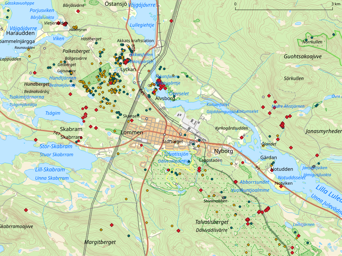
Generate map with observations within a 10km-wide square centered in Jokkmokk, Norrbotten.
$ gis-observation-map --margin 5000 --point 7395788,713523 \
    --project-name=Jokkmokk --project-home=/path/to/Jokkmokk
1516 observations found
Generate map with observations within or nearby mining exploration permits and processing concessions, using a custom style for the objects of interest.
$ gis-observation-map --margin 2500 \
    --geometry-style /path/to/Mineralrättigheter.qml --geometry /path/to/jokkmokk-sgu.geojson \
    --project-name=Gruvor --project-home=/path/to/Jokkmokk-Mineral
5304 observations found
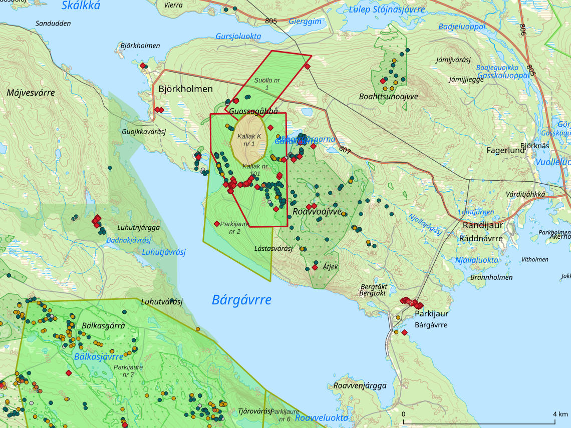
Zoom in on the Gállok area (Jokkmokk Municipality, Norrbotten).
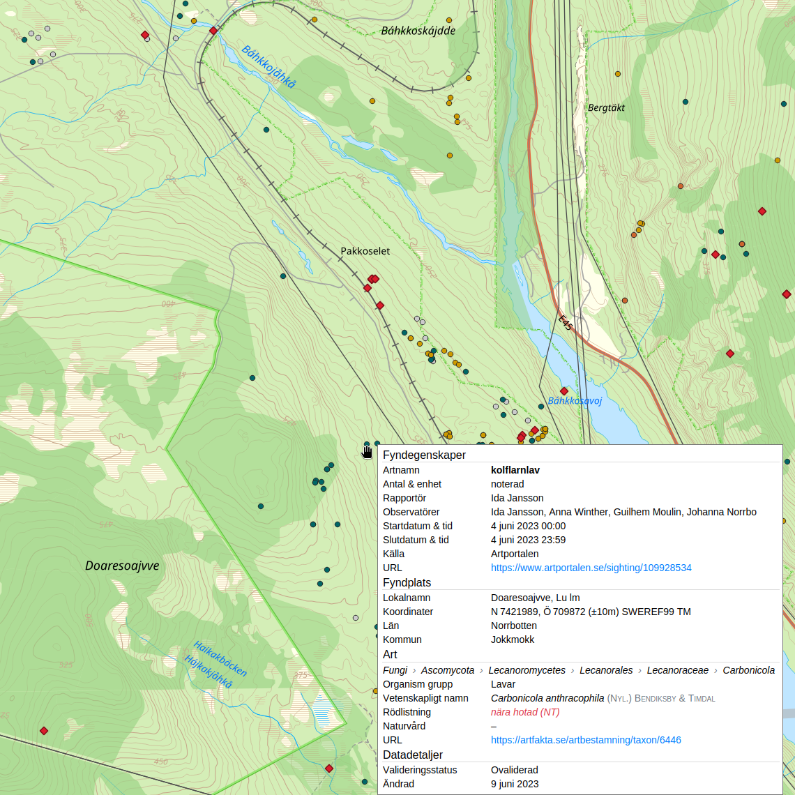
Show details for a specific observation near Doaresoajvve (Jokkmokk Municipality, Norrbotten).
Contribute
$ git clone https://git.guilhem.org/gis-observation-map.git